TEMPORARY TRAIL DETOURS
ALONG THE LAURA SECORD LEGACY TRAIL
Summer 2022…
There are two temporary diversions along the Laura Secord Legacy Trail (one on Stage 3, and one on Stage 5. Details are below!
STAGE 3 TEMPORARY DIVERSION DUE TO ROAD CONSTRUCTION – GALE CRESCENT AT GENEVA STREET (JUNE-AUG 2022)
Roadwork is occurring south of the intersection of Geneva Street and Gale Crescent (Step 53 of the Laura Secord Trail Guide), necessitating a temporary re-route of Stage 3 of the LSLT. The closest crosswalk with a crossing signal is at Niagara Street, 250 m north of Gale Crescent. PLEASE USE IT TO CROSS GENEVA STREET, and exercise caution when passing the construction site.No signs have been installed to show this detour, and it is NOT reflected in the latest LSLT 2022 Trail Guide, since these disturbances are temporary – but please be careful when walking this section!
Map showing temporary diversion:
https://www.google.com/maps/d/u/0/edit?mid=1-Pfu5ZUca3Em88XLdfS8PgKSTS-RQPhL&usp=sharing
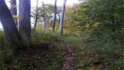
STAGE 5 TEMPORARY TRAIL DIVERSION NEAR DECEW WATER TREATMENT PLANT – SUMMER 2022 CONSTRUCTION WORK NEAR THE DECEW WATER TREATMENT PLANT (Step 93 of the LSLT Trail Guide) has resulted in several large mounds of gravel being dumped on the trail, blocking the path completely. If you’re hiking that section, It is not very safe to walk over these piles – so a couple of minutes detour is needed – make a left turn before the piles and go around the trees to get to the far side of the mounds. No signs have been installed to show this detour, and it is NOT reflected in the latest LSLT 2022 Trail Guide, since these disturbances are temporary – but please be careful when walking this section!
Map showing temporary diversion:
https://www.google.com/maps/d/u/0/edit?mid=1kAicOFkP_SDY8vqUxsVEn39X9hA&usp=sharing
HAPPY TRAILS!

TURN
BY TURN
DIRECTIONS
and TRAIL GUIDE
Third Edition
June 2022

LAURA SECORD LEGACY TRAIL
Turn-By-Turn Directions –
Third Edition – JUNE 2022
Also available online in web and PDF format at www.friendsoflaurasecord.com
IMPORTANT DISCLAIMER – PLEASE READ CAREFULLY
|
TRAIL SIGNAGE, DIRECTIONS , LANDMARKS,
WAYFINDING INFORMATION AND OTHER DETAILS ASSOCIATED WITH THE LAURA SECORD
LEGACY TRAIL IN THIS DOCUMENT AND ELSEWHERE (INCLUDING INTERNET AND
ELECTRONIC SOURCES) ARE PROVIDED ONLY AS A CONVENIENCE, AND DO NOT CONVEY ANY
LEGAL AUTHORITY OR RIGHT OF ACCESS. ACCESS TO PROPERTY IS ENTIRELY AT THE
DISCRETION OF THE RELEVANT LANDOWNERS AND JURISDICTIONAL AUTHORITIES.
PROPERTY ACCESS AND USE ARE GOVERNED BY ALL PERTINENT AND APPLICABLE
REGULATIONS IN FORCE AT THE TIME OF ACCESS. TRAIL SURFACE INFORMATION, HEALTH
AND SAFETY WARNINGS, AND OTHER INFORMATION RELATED TO THE LAURA SECORD LEGACY
TRAIL ARE SUBJECT TO CHANGE. TRAIL CONDITIONS MAY BECOME HAZARDOUS AT ANY
TIME DUE TO WEATHER, EROSION, OR OTHER UNFORESEEN EVENTS. ACCESS TO AND USE
OF TRAILS IS ENTIRELY AT YOUR OWN RISK. FRIENDS OF LAURA SECORD, PROPERTY OWNERS,
AND RELEVANT JURISDICTIONS ASSUME NO LIABILITY OR RESPONSIBILITY FOR YOUR USE
OF THE LAURA SECORD LEGACY TRAIL OR OTHER ASSOCIATED TRAILS AND FEATURES, NOR
ARE THEY LIABLE IN ANY WAY FOR YOUR HEALTH, SAFETY, OR CONDUCT. |
|
|
|
|
|
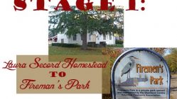
STAGE 1 – LAURA
SECORD HOMESTEAD TO FIREMEN’S PARK Start: Laura Secord Homestead, 29 Queenston St., Queenston, ON. Available online: STAGE 1 GOOGLE MAP (HOMESTEAD TO FIREMEN’S PARK) |
|
1
|
DIRECTIONS TO TRAILHEAD – The Laura Secord Legacy Trail starts on the
sidewalk in front of the Laura Secord Homestead – 29 Queenston
Street, Queenston, Ontario. Start at the stone marker beside the main
gate on Queenston Street. |
|
2 |
Walk down Queenston Street – From the stone marker beside the main gate in front of
the Laura Secord Homestead, walk down Queenston Street until you reach the
intersection with Dee Road (400 m). Dee Road is a small lane, and hard to
see, but watch for a red brick house on your left. Dee Road is just
after that house, on your left. |
|
3 |
Left onto Dee Road – Turn left (west) onto Dee Road. Continue walking
straight ahead on Dee Road towards the Niagara Parkway (300 m). |
|
4 |
Cross the Niagara Parkway – Head straight across the Niagara Parkway to the unpaved
Dee Road farm access road directly opposite. CAUTION: High
traffic area – Please proceed carefully! |
|
5 |
Continue on farm access road – Continue west on Dee Road farm access road (850 m). At
the end of this farm access road, you will arrive at a ‘T’ junction, the
intersection with Concession 1 road (also unpaved). |
|
6 |
Turn left on Concession 1 road
allowance – At the ‘T’ junction, turn left
(south) onto the unpaved Concession 1 road allowance and follow it to York
Road (600 m). It becomes a narrower dirt path up ahead. |
|
7 |
Cross York Road – You’ll emerge from the woods onto York Road, a
well-used, paved, two lane regional highway. CAUTION: High
traffic area – Please proceed carefully! |
|
8 |
Walk along shoulder of York Road – Continue west along the south shoulder of York Road to
the intersection with Concession 2 Road. Just past the intersection with
Concession 2 road, you’ll see a massive stone wall – the remains of an old
railway bridge abutment. |
|
9 |
Into the woods behind the old
railway bridge abutment – Just before
the old railway bridge abutment, look for a couple of trail signs (Laura Secord
Legacy Trail and Bruce Trail) directing you to turn left into the woods
and follow the trail up and behind the stone wall. Just follow the trail
marker sign into the woods. |
|
10 |
Follow the signs and paint blazes
– Follow the signs and the blue
paint blazes on the trees. They will take you past the trail
intersection with Kilometre 4.3 of the Bruce Trail. Continue on the shared
Laura Secord Legacy Trail / Bruce Trail (white paint blazes) along the edge
of the escarpment, all the way to the intersection with Stamford Townline
Road (about 2.0 km). |
|
11 |
Right on Stamford Townline Road – Exit the woods and turn right (west) onto Stamford
Townline Road. Walk out to the stop sign at the intersection with Four
Mile Creek Road / St. Paul Avenue (60 m). |
|
12 |
Left at the stop sign, onto
shoulder of St. Paul Avenue –
Turn left (south) and follow the shoulder along the left hand (east) side of
St. Paul Avenue, walking up the hill. You will pass underneath the highway
405 overpass. Continue up the hill for 550 metres, or about 6 minutes. Watch for the right arrow
sign that points you across St. Paul Avenue. That’s where you’ll and
enter the woods again on the opposite side of the road. CAUTION: HIGH
TRAFFIC AREA! |
|
13 |
Cross St. Paul Avenue – At the right arrow sign, cross St. Paul Avenue onto the
shared Laura Secord Legacy Trail / Bruce Trail, marked by a dirt path, trail
sign, and white paint blazes. |
|
14 |
Through the woods – Follow the shared Bruce Trail and Laura Secord Legacy
Trail signage through the woods (1.1 km) until the trail emerges on
Dorchester Road. The railway tracks run parallel to the trail at this
point. |
|
15
Portable
toilet at Firemen’s Park on Laura Secord Day ONLY |
Cross Dorchester Road – Walk across Dorchester Road into the parking lot at lower
Firemen’s Park. The official end of Stage One of the Laura Secord
Legacy Trail is located in the gated car park in Fireman’s Park, immediately
across Dorchester Road. This is the end of
Stage 1. NOTE: Stage 2 of the Laura Secord Legacy Trail
continues on the opposite side of the railroad tracks, just up the hill.
Cross over the tracks and look for the railway signal control box. The
trail heads into the woods, on your right, immediately alongside the control
box. CAUTION: RAILWAY CROSSING – Watch and listen
for trains! |
|
|
|
|
|
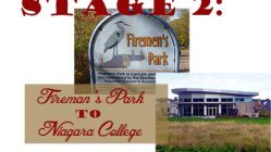
Start: Lower (north) car park, Firemen’s Park west of Dorchester Rd,
Niagara Falls, ON. Available online: STAGE 2 GOOGLE MAP (FIREMEN’S PARK TO NIAGARA COLLEGE) |
|
16 |
Stage 2 of the Legacy Trail
officially starts at the parking lot at lower Firemen’s Park, west of
Dorchester Road and north of the CN Railway. The trailhead itself is just
south of the railway tracks on Dorchester Road. |
|
17 |
DIRECTIONS TO TRAILHEAD: From the gated car park in lower Firemen’s Park, head
south on Dorchester Road, across the railway tracks. Cross over the
tracks and look for the railway signal control box on the right. The trail
goes into the woods, on your right, immediately alongside the control
box. CAUTION: RAILWAY
CROSSING – Watch and listen for trains! |
|
18 |
Into the woods – Follow the Laura
Secord trail signs and white paint blazes into the woods. This section of
trail heads west just south of the railway line, then skirts the north
edge of the Mountain Road Landfill Site, enters Mewburn
Park (an undeveloped passive park in Niagara Falls), heads south along
the east edge of Mewburn Road to avoid the car
traffic on the railway overpass, and intersects Mewburn
Road about 200 m south of the overpass. |
|
19 |
Cross Mewburn
Road – The
Laura Secord Legacy Trail crosses Mewburn
Road where the steel roadside barrier ends about 200 m south of the
railway overpass. Cross the road carefully, watching for fast-mocing traffic. On the west side of Mewburn
Road, turn right and head north again until you are just south of the
railway embankment. Turn left on the trail and continue walking west on the
south side of the railway embankment for 70 m. The trail is marked with FLS
signs and Bruce Trail blazes. In rainy weather, it may be rutted and muddy. |
|
20 |
Passing stormwater ponds – 50m west of Mewburn Road, you
will pass 3 leachate ponds south of the trail. About 400m later, the trail will
turn south (left) along a ravine for 140 m, before U-turning and heading
north again up the west side of the same ravine. CAUTION: depending upon season and weather
conditions, the bottom of the ravine may be wet and muddy. |
|
21 |
Approaching CN Railway and QEW – As you approach the CN railway line from the south, the
trail will veer left (west) and meander through the woods for 330 m to the
intersection with the Queen Elizabeth Way (QEW) highway. |
|
22 |
Cross the QEW on the Sand Plant Hill Footbridge. From the west end of the Sand
Plant Hill Footbridge, the trail descends to grade level and follows the
south side of the CN railway for 360 m before making a sharp right turn and
passing through the 25m long ‘Screaming Tunnel’ under the train tracks. |
|
23 |
Through the Screaming Tunnel – Walk through the 25m long ‘Screaming Tunnel’, a quarried
limestone tunnel that runs under the present-day CN (once Grand Trunk)
Railway line. Be careful as you make your way through this
dark and wet railway underpass. There is frequently running or standing water
in the bottom of the tunnel. The stepping stones installed by fellow hikers,
though convenient, are often slippery and unsteady. |
|
24 |
Exit the Screaming Tunnel and turn left (west) on Warner
Road. Coming up –
about 270 metres past the intersection with Garner
Road – the trail will take a sudden hard right turn. It’s hard to see, but look
for a small green and white address
plaque alongside a private driveway with the number 9101 – it
will be on your right. About 50m past that address sign, you will see a
pathway and a metal gate on the north side of the road. |
|
25 |
Abrupt right turn
off Warner Road – 50 m west of the driveway for 9101 Warner Road, the trail takes an abrupt right turn off the road, past a
metal gate, and through a patch of woods,
skirting the western edge of 9101 Warner Road (a privately owned property,
with right of passage granted to the Bruce Trail
Club). The
trail junction is marked with Laura Secord Signs and Bruce Trail directional
signs and blazes. |
|
26 |
Follow the trail north for 100 m
towards the open agricultural field. On the edge of the field, veer left
(west) along the edge of the field. The path will curve towards the northeast
as it follows the edge of the farm field.
|
|
27 |
At the north edge of the field,
about 175 m north of where you entered it, the trail will enter the woods.
Follow the FLS and Bruce Trail markers as the trail heads northeast through
the woods, along the southern edge of Woodend Conservation Area. |
|
28 |
In about 400 m, the trail will
fork. Keep right at the fork, following the FLS and Bruce Trail markers.
In about 200 metres,
the trail will curve left and run parallel to the Queen Elizabeth Way.
You should be able to hear the traffic and see the QEW up ahead. |
|
29 |
When you
arrive at the Niagara College Wetland Ponds, turn right
and follow the path north along the west edge of both of the ponds. At the end of the path, turn left and follow the trail along the
north edge of the pond, which takes you towards Niagara College. |
|
30 |
When you
reach the west end of the pond, your path will intersect the main Wetland
Ridge trail near the First Nations, Metis, and
Inuit Garden. Turn right and walk north along the trail past the utility yards
and barns of Niagara College until the path curves into the Niagara College
car park. |
|
31
|
Entering the main campus of
Niagara College – When you reach the paved entrance
road to the Niagara College car park, turn left and follow the signs
that will take you through the College campus. Follow the shoulder of the road as
it curves south and then west towards the Wine Visitor and Education Centre. |
|
32 |
Make your way to the bus stop and Transit
Loop – Cross the road and make
your way across the Niagara College campus to the Transit Loop and bus
stops in front of the main college building, under the big blue ‘nc‘ logo. This is the end of
Stage 2. |
|
|
STAGE 3
– NIAGARA COLLEGE to RODMAN HALL Start: Main bus stop at Niagara College Transit Loop (under the big
blue ‘nc‘ logo in front of the main entrance), 135 Taylor
Road, Niagara on the Lake, ON. |
|
33 Toilets
in Mall / |
Stage 3 begins at the Transit Loop bus stop in front of
the main entrance of Niagara College, under the big blue ‘nc‘
logo. |
|
34 |
Turn right onto Taylor Road
towards Glendale Avenue – When
you reach Taylor Road, turn right and walk towards the traffic lights and the
pedestrian cross walk at the main intersection with Glendale Avenue. |
|
35 |
Cross Glendale Avenue and Taylor
Road, then walk towards McDonald’s and Starbucks – At the traffic lights, carefully cross Glendale Avenue
using the pedestrian crosswalk. On the other side prepare to cross Taylor
Road. You’ll be heading towards McDonalds, and the Outlet Mall. Continue
along the sidewalk on the west side of Taylor Road, towards McDonalds and
Starbucks. |
|
36 |
Cross the Outlet Collection Mall
entrance road and continue along the sidewalk – Carefully cross using the pedestrian crosswalk. |
|
37 |
Continue walking to the end of the
sidewalk in front of the mall on Taylor Road. When the sidewalk ends, you can choose to continue walking
on the shoulder of Taylor Road itself, or walk along the grassy verge in
front of the car park at Leon’s Furniture. |
|
38 |
Carefully cross Homer Road and
continue along the shoulder of Taylor Road.
Up ahead, Taylor Road will curve north towards the intersection with York
Road and Highway 55, in the shadow of the Garden City Skyway. You’ll be
turning left at the traffic lights, heading west on York Road (which will
turn into Queenston Street on the other side of the Homer Lift bridge). |
|
39 |
Turn left at the traffic lights
onto York Road (which will become Queenston Street on the other side of the
Homer Bridge). Make your way carefully
along the shoulder of the road. Walk carefully, facing the traffic. The
Garden City Skyway will be on your right, and high above you. You will also
pass the Homer Cemetery on your left, and the sign which marks the municipal
border between Niagara-on-the-Lake and St. Catharines. |
|
40 |
Walk west towards the Welland
Canal along the south shoulder of York
Road (which becomes Queenston Street on the other side of the Homer Bridge). CAUTION: High
traffic area – Please proceed carefully! |
|
41 |
Cross the Homer Lift Bridge over
the Welland Canal (240 m). Use the
pedestrian pathway on the south (left) side of the Homer Bridge. You may have
the opportunity to view ships if the lift bridge is up. |
|
42 |
Cross the Welland Canals Parkway
Trail intersection, and continue west along Queenston Street. After crossing the bridge you’ll
come to a set of traffic lights at the intersection of the Welland Canals
Parkway Trail. Keep walking straight ahead along Queenston Street, heading
west. CAUTION: High
traffic area – Please proceed carefully! |
|
43 |
Continue west along the south side
of Queenston Street. You
will pass Victoria Lawn Cemetery, and cross Emmett Rd and Spring
Street on your way to Bunting Road (1.3 km). CAUTION: High traffic
area – Please proceed carefully! |
|
44 |
Cross the busy intersection at
Bunting Road and Queenston Street at the crosswalk. Continue on Queenston Street to Hartzell Road (400 m). CAUTION: High
traffic area – Please proceed carefully! |
|
|
45 |
Cross the busy intersection at
Hartzell Rd. Continue west along Queenston St.
for 900 m to Westchester. |
|
|
46 |
At the intersection of Queenston
Street and Westchester Crescent, directions get a bit tricky
– so pay attention! Cross over Westchester Crescent
and immediately turn left, but do
not go straight down the hill on Westchester Crescent. Instead, follow the sidewalk
that heads along Eastchester Avenue and down the hill on the diagonal. You
will see a one-way street sign that directs you onto Eastchester
Avenue. Follow the sidewalk down Eastchester Avenue. THIS
INTERSECTION CAN BE A BIT CONFUSING… CHECK THAT YOU ARE |
|
|
47 |
Keep following Eastchester Avenue southwest (downhill) for about 200 metres,
until you meet the intersection with Oakdale Avenue. |
|
|
48 |
|
|
49 |
Cross Oakdale Avenue and enter the
car park, then turn right and head past
the road barrier into the valley. Follow the trail into Centennial Park. All along this section of the
trail, partially hidden by the vegetation on your left, is Dick’s Creek. This creek was part of
the original Welland Canal system, and is believed to be named after celebrated
Black Loyalist Richard ‘Captain Dick’ Pierpoint, who was granted land in this area. You’ll see
a plaque commemorating him beside the car park. |
|
50 |
Keep walking along the trail
(shared with the Merritt Trail) into Centennial Park. Up ahead, in about 500 metres,
you’ll see the former Totem Pole Garden. (The Totem Pole itself was removed
for restoration in December 2019, but its circular base can still be seen). Keep
walking along the trail. |
|
51 |
After the Totem Pole Garden,
continue walking west on the Merritt Trail for 180 m, then bear right on the paved section of the
trail. Follow the trail up the staircase
and emerge on Riordan Drive.
Follow the left (west) sidewalk of Riordan Drive to the intersection with
Gale Crescent. |
|
52 |
|
|
53 |
Turn left on Geneva Street. Walk south on Geneva Street for 70 m. At the traffic
light, CAREFULLY cross over the Hwy 406 off- ramp and continue walking
SOUTH. CAUTION: High
traffic area – Please proceed carefully! |
|
54 |
Cross Geneva Street to the
opposite corner using the pedestrian crosswalk. You’ll be on the southeast corner of Geneva Street and
Race Street. (Race Street turns into McGuire Street up ahead). Watch for the
street marker signs, and again, please be careful of traffic here. CAUTION: High
traffic area – Please proceed carefully! |
|
55 |
CAREFULLY cross over to the
sidewalk on the opposite side of Race Street / McGuire Street. Turn left and continue walking west on the street. It will
bear slightly south west. CAUTION: High
traffic area – Please proceed carefully! |
|
56 |
Continue walking southwest on Race
Street. Keep left on the sidewalk along
Race Street. Just ahead, you will cross Carlisle Street and David S. Howes
Way as you pass in front of Brock University’s downtown campus – the Marilyn
I Walker School for Fine and Performing Arts. Further ahead is the Meridian
Arena. CAUTION: High
traffic area – Please proceed carefully! |
|
57 |
Cross Carlisle Street. At this point, Race Street becomes McGuire Street. Continue walking southwest along Race
Street. You’ll pass the entrance ramp to
Highway 406, and walk under the Westchester Avenue viaduct. (Highway 406 is a
major north-south highway which runs from the Queen Elizabeth Way (QEW) here
in St. Catharines along the valley of the Twelve Mile Creek and then
continues south to East Main Street in Welland). CAUTION:
Construction and high traffic area – Please proceed carefully! |
|
58 |
At the foot of St. Paul Crescent
cross straight over McGuire Street.
Look straight ahead, and take the pedestrian bridge that crosses
over Highway 406. At this point the Laura Secord Trail shares
the pathway with the Merritt Trail. After you’ve crossed Highway 406
on the pedestrian bridge, the ramp takes you down into the valley of Twelve
Mile Creek. Walk over Hwy 406 on the
pedestrian bridge and turn right, following the ramp down into the valley of
Twelve Mile Creek. Follow the trail along the creek (350 m) to the steel
truss bridge. |
|
59 |
Crossing Twelve Mile Creek – Up ahead is the steel truss bridge. Turn left onto
the pedestrian walkway of the bridge, and cross over Twelve Mile Creek.
Once you’ve crossed the creek, you are back on the continuation of St. Paul
Crescent. You will follow St. Paul Crescent all the way to Rodman Hall, about
350 metres up the hill. |
|
60 |
Continue straight ahead (south)
along St. Paul Crescent for 350 m
towards the entrance of Rodman Hall. (Alternatively – if conditions permit –
you can make your way diagonally across the front lawn and up the hill to the
Rodman Hall car park). |
|
61
|
Arriving at Rodman Hall – Climb up the hill and walk across the lawn, or turn left
into Rodman Hall Drive, and enter the grounds of Rodman Hall Arts Centre. This is the end of Stage
3. |
|
||
Laura Secord Legacy
Trail volunteer trail inspectors (l to r): |
Special thanks to our trail
volunteers! Special thanks to: Mike and Judy Fox, Pamela Ward, John Convey,Cate
Mee, Roy McCormick, Bryant Prosser (trail inspection and signage inventory);
Ross Macdonald, Lori Steglinski, Leah Bercovitch (trail routing and mapping); Bruce and Robin
Hogg and the Sunflowers Cycling Club; Paul Humber; Rick Waters and the
Niagara Bruce Trail Club (trail maintenance); Shannon Millar, Matt MacMillan,
Niagara Region and municipalities, and everyone else who has assisted with
route planning, mapping, and trail creation and maintenance. |
|
|
STAGE
4 – RODMAN HALL TO ROTARY PARK Start: Front door of Rodman Hall, 109 St Paul Crescent, St. Catharines, ON L2S 1M3. Available online: STAGE 4 GOOGLE MAP (RODMAN HALL TO ROTARY PARK) |
|
|
62 |
Leave the front entrance of Rodman
Hall and turn right towards the
entrance of the Walker Botanical Gardens. Follow the staircase down through
the Walker Botanical Gardens, past the outdoor amphitheatre. |
|
|
63 |
Rodman Hall to the edge of Twelve
Mile Creek – Stay on the path as it winds down
the hillside until it emerges on the main Laura Secord Legacy Trail, about
350 m. At the bottom of the hill, you’ll
be turning right and walking south along the wide gravelled
expanse of the Laura Secord Legacy Trail. |
|
|
64 |
Turn right and walk south along
the wide gravelled expanse of the Laura Secord
Legacy Trail (former Participark
Trail). As you walk along the trail, Twelve Mile Creek will be on your
left. Up ahead, in about 450 metres, is the CN Rail Bridge. Continue walking
south towards that bridge. |
|
|
65 |
Cross under the CN Rail Bridge (450 m) and continue walking south on the Laura Secord
Legacy Trail. |
|
|
66 |
Approaching the Western Hill Side
Trail – About 900 m south of the CN Rail
Bridge, you will pass the intersection with the Western Hill Side Trail,
which hairpins up the bluffs under the power lines to the right. Continue
south on the main Laura Secord Legacy Trail, keeping Twelve Mile Creek on
your left. |
|
|
67 |
Approaching the Glendale Avenue
Pedestrian Bridge – Just before the Laura Secord
Legacy Trail intersects with Glendale Avenue, you’ll see the Glendale Avenue
Pedestrian Bridge at Old Glendale Avenue. |
|
|
68 |
Make a left turn towards the
Glendale Avenue Pedestrian Bridge
(40 m) but do not cross it. Instead, turn right and follow
the Laura Secord Legacy Trail south, past the Ontario Power Generation (OPG)
barrier gate. |
|
|
69 |
Approaching the storm water
retention pond – About 900 m south of the Glendale
Avenue Overpass, you will come upon a large storm water retention pond on
your right. Follow the path as it hugs the south eastern edge of the
retention pond. Keep the pond on your right. After you’ve reached the end of
the pond, bear left along the trail that follows Twelve Mile Creek. |
|
|
70 |
Crossing Elk Street Flats – Stay on the trail as it meanders through the Elk Street
Flats. This is a low-lying area that is undergoing reforestation. After 600 m
you will come to a small rise, where you will begin your ascent to Rotary
Park. |
|
|
71 |
Bear right at the trail
intersection – After 160 m, the main gravel trail
will make a sharp left turn towards a leachate pumping station. Do not follow it; instead, bear RIGHT at this corner and follow the trail
WEST for 100 m towards the stand of pine trees on the hillside (Rotary Pines
North). |
|
|
72 |
Up through the pines to Rotary
Park – Follow the path up the
hillside and through the pines towards Rotary Park. |
|
|
73 |
Entering Rotary Park – As you emerge from the trees at the top of the hill,
you’ll be entering Rotary Park. Turn left here, and follow the curving trail
towards the large circular stone structure about 50 m ahead. It is hard to
tell from here, but it is a raised stone garden featuring the Rotary
International Logo. |
|
|
74 Portable
toilet |
Friendship Garden – Rotary Logo – The raised circular garden on the edge of Rotary Park is
known as the Friendship Garden. It displays a large Rotary International
logo, surrounded by ornamental grasses and junipers. The 24 foot wheel, made
of steel, is said to symbolize movement and civilization. This is the end of
Stage 4. |
|
|
Portable toilet |
Start: Rotary Park
(entrance opposite 392 Pelham Street, St. Catharines L2S 0A2) (at Rotary International logo). Available online: STAGE 5 GOOGLE MAP (ROTARY PARK TO DECEW HOUSE) |
|

|
75 |
Stage Five begins immediately in front of the big blue and
yellow Rotary International logo. From the Rotary International logo, walk along the
path towards the large boulder with the bronze plaque. |
|
76 |
|
|
77 |
From the main (Pelham Road) entrance to Rotary park, look
for the Laura Secord Legacy trail marker, and walk south along the wide
gravel path, keeping Pelham Road to your right. Follow the path until it bears
left. At the bend, you’ll see the marker
for the Laura Secord Legacy Trail, which continues straight ahead,
heading south. Leave the wide gravel path, and follow the trail. On the opposite side of the
parking lot you will see a gravel path that heads south, and then bends left
(east) through a stand of pine trees (Rotary Pines South) towards the valley
of the Twelve Mile Creek. Follow this pathway down the hillside and into the
valley. |
|
78 |
Descending towards Rotary Pines
South – Keep heading east on the trail
into a stand of pine trees. This grove of trees is called Rotary Pines
South. Follow this pathway down the hillside
and into the valley. |
|
79 |
Entering the power line corridor –
The trail emerges into a wide
power line corridor and curves right. In late fall, winter, and early
spring, you will have a good view from here of the DeCew Power Generating
Station on the opposite (east) side of the creek. Follow the trail ahead as it
crosses under the power lines and continues into the woods. |
|
80 |
Enter the woods on the opposite
side of the power line corridor. Continue
down the trail as it descends into the valley of Twelve Mile Creek. |
|
81 |
Gate at DeCew Power Generating
Station – At the bottom of the valley, the
trail emerges at the foot of Tailrace Road by the gate of the DeCew Power
Generating Station. Follow the trail which parallels
the chain-link fence to the right of this gate. CAUTION: This section of the trail can be
very wet, muddy, and slippery. |
|
82 |
When the fence ends, bear left on
the trail and climb up on the slight rise to
the old DeCew Power Plant access path. Follow the earthen trail (dirt
path) south, beside Twelve Mile Creek. The creek is much narrower here, upstream
from the power station. |
|
83 |
Ruins of the Peter Thomas Mill Dam
– About 650 m after the end of the
power station fence, look left. You will see the ruins of the old Peter
Thomas Mill Dam bridging the Twelve Mile Creek. You can view it from a small
lookout to the left of the main trail. Return to the main trail and continue
south. |
|
84 |
Climbing the ‘hogsback’ ridge – About 50 m south of the Mill Dam, you will come to a
trail junction. Bear RIGHT and follow the gravelled
section of the trail as it climbs the ‘hogsback’ ridge. Follow the hogsback
trail as it descends and eventually crosses the 12 Mile Creek at what’s now
known as ‘The Bridge at Laura’s Crossing’. |
|
85 |
Looking down on the Bridge at
Laura’s Crossing – As you descend the slope from the
hogsback, look through the trees on your left and you should be able to see
the metal span of The Bridge at Laura’s Crossing. At the bottom of the hill, at the
trail junction, turn left and head towards the bridge. You’ll be using this bridge to cross Twelve Mile Creek. |
|
86 |
Cross the Bridge at Laura’s
Crossing into Laura’s Meadow. The Bridge at Laura’s Crossing was
installed in May 2013, and officially dedicated on June 22 – exactly two
hundred years to the day after Laura Secord’s momentous journey. As you cross
this simple but unique bridge, remember that according to her own accounts,
Laura Secord crossed the 12 Mile Creek on a fallen log. This footbridge,
built with generous donations by the Toby family and Rankin Construction and
based on a design donated by the Government of New Zealand, makes the
crossing a whole lot easier. |
|
87 |
After crossing the bridge, continue straight on the trail across Laura’s Meadow,
towards the Escarpment. (250 m). |
|
88 |
Up the escarpment to the ‘Bench on
the Bench’ – Follow the gravel trail up the
hill, and into the woods. Soon you’ll see a log seating area on a gentle
slope of the escarpment, a level area known geologically as a ‘bench’. |
|
89 |
Take either trail branch – Just after the Bench, the trail splits (left or right).
You can take either branch. Both paths will converge further up the
escarpment, but the right branch is a little longer. |
|
90 |
Trail convergence – On the brow of the Escarpment, the Laura Secord Legacy
Trail rejoins the Bruce Trail. Stay on the trail as it heads southwest
towards the ‘nose’ of the Escarpment (370 m), and then back eastward
overlooking the valley of Beaverdams Creek for 450 m. You will soon see the
gorge of DeCew Falls on your right, as you approach at DeCew Falls and
Morningstar Mill. |
|
91 Permanent |
Approaching Morningstar Mill – As the trail approaches DeCew Falls and Morningstar
Mill, you will come to a trail junction. The Laura Secord Legacy Trail
turns left there, and head north. If you turn right at the junction,
you’ll end up on the Morningstar Mill property. Morningstar Mill is definitely
worth a visit. But if you choose to visit the Mill, note the trail
junction where the Laura Secord Legacy Trail continues so you can return and
continue your walk. |
|
92 |
Along DeCew’s Field – At the junction where the trail splits towards
Morningstar Mill, turn left and follow the trail for 200 metres along the west edge of the Niagara Region’s DeCew
Water Treatment Plant. On your left you’ll see two small
brick buildings – these are pumping stations. The open grassy field, on your
left, is part of DeCew’s Field. Somewhere in that field Laura Secord had her
famous encounter with the First Nations warriors. |
|
93 |
Past the ponds and trees to the
reservoir – About 50m past the pumping
station building you will see two round settling ponds at the water
treatment plant. On your left, just before the gate to the settling ponds,
look for a small pathway that leads past a grove of trees. It will curve
towards the stone wall of the Lake Moodie Hydro reservoir. Follow that path. |
|
94 |
Up the reservoir wall – Carefully climb the angled path up the stone wall of the
reservoir, and turn right when you reach the top. The trail continues along
the top of the wall. Once you’re there you’ll see some sweeping views of the
escarpment, and the complete reservoir system. |
|
95 |
Continue on top of the reservoir
wall – Stay on the trail atop the
crushed stone berm as it follows the edge of the reservoir. Keep the
reservoir on your left. Up ahead you’ll be approaching Decew Road. Stay on the raised trail as it
follows the south edge of the reservoir, parallel to Decew Road. |
|
96 |
Remain on the trail on top of
the reservoir wall as it curves away from Decew
Road along the edge of the reservoir for 130 m and descends to
grade level. |
|
97 |
Down from the reservoir wall to
the trail – The path descends from the stone
reservoir wall, and follows a short section of the shoreline of Lake Moodie
before heading east through forest and meadow (400 m). Follow the trail as it
heads into the forest. The forest can be damp through
here – watch out for mud puddles! The trail will turn left (north)
for 80 m, and then make a sharp right turn towards the southeast at the
water’s edge. |
98 |
Turn right when the trail reaches
the shoreline – On this stretch of trail, you will
approach a hydro feeder canal which supplies water to the Decew Falls
Generating Station (which is located on the edge of the escarpment just north
of this location). Make a sharp right turn along the
water’s edge. Be careful – the banks can be slippery, and the water here
is fast-flowing and very dangerous. It connects the Lake Moodie hydro
reservoir system with Lake Gibson. At this point, you will be on the
final approach to DeCew House Heritage Park. |
|
99 |
Arriving at Decew House Heritage
Park – The final approach to DeCew
House follows the swift-flowing channel connecting Lake Moodie and Lake
Gibson for 300 m before emerging at DeCew House Heritage Park. Decew House Heritage Park, which
is the end of Stage 5 (and of the Laura Secord Legacy Trail). Decew House is
where Laura Secord came to deliver her fateful message to Lieutenant
Fitzgibbon, and walked into history. The park is also the location of
the First Nations Peace Monument,
designed by celebrated Canadian architect Douglas Cardinal. |
|
100
|
Congratulations –
you’ve just followed in Laura Secord’s footsteps! |
|
|
THE FOLLOWING ONLINE MAPS CAN BE
FOUND UNDER THE ‘TRAILS’ TAB ON STAGE 1 GOOGLE MAP (HOMESTEAD TO FIREMEN’S
PARK) |
|
|
|
© 2022 Friends of Laura Secord. Compiled and edited by
David T. Brown. Additional editorial revisions by Roy McCormick, Anthony
Montagano, Caroline McCormick and Barbara Worthy.
Special thanks to Mike and Judy Fox,
Pamela Ward, John
Convey, Cate Mee, Roy McCormick, Bryant Prosser, Ross Macdonald, Lori Steglinski, Leah Bercovitch, Bruce
and Robin Hogg and the Sunflowers Cycling Club; Paul Humber; Rick Waters and
the Niagara Bruce Trail Club, Shannon Millar, Matt MacMillan, Niagara Region
and municipalities, and everyone else who has assisted with route planning,
mapping, and trail creation and maintenance.
Add comment